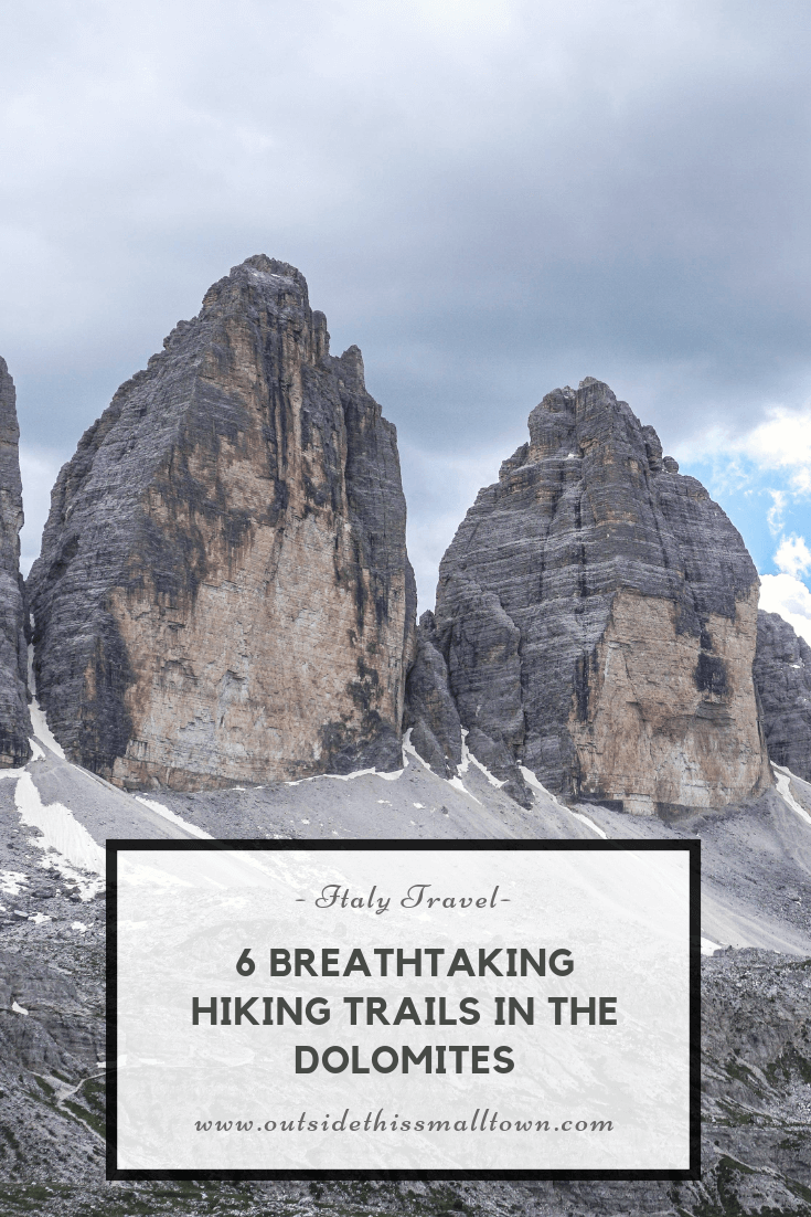
6 Breathtaking Hiking Trails in the Dolomites
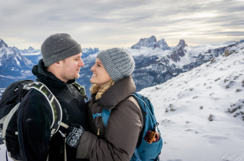
Living within viewing distance of the Dolomites has undoubtedly left a permanent mark on my heart. I wake up every morning and drive my husband to work hoping that the sky is clear enough to get even a glimpse of them as the sun is rising and hitting the peaks, giving them a pink hue. Every mountain range we visit compares in no way shape or form to the Dolomites. They are unique, breathtaking, and will always provide unlimited adventures.
Hiking in the Dolomites has become my peaceful outlet, where I seek mental clearness, and where I feel comfortable. I have been left speechless by its beauty and at the same time overwhelmed by the physical aptitude required by the more difficult routes. I have experienced every emotion possible on these mountains, and yet I haven’t even scratched the surface with experiencing all the trails here.
But, I have seen enough to fall head over heels in love with these mountains. And you will too if you keep reading and/or look at the photos I’ve managed to capture along the way. I’ve put together a list of the best hiking trails in the Dolomites that I’ve completed, ranging from easy to hard. All hikes are doable in less than a day and these were all done as a day trip from my home in Vicenza, Italy.
I hope this inspires you to visit this beautiful mountain range or to at least get outdoors and explore what is around you. Nature is a wonderful thing.
Table of Contents
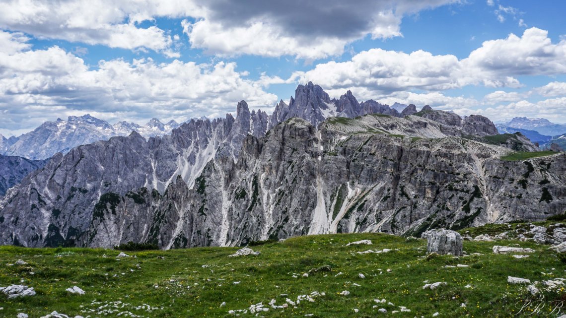
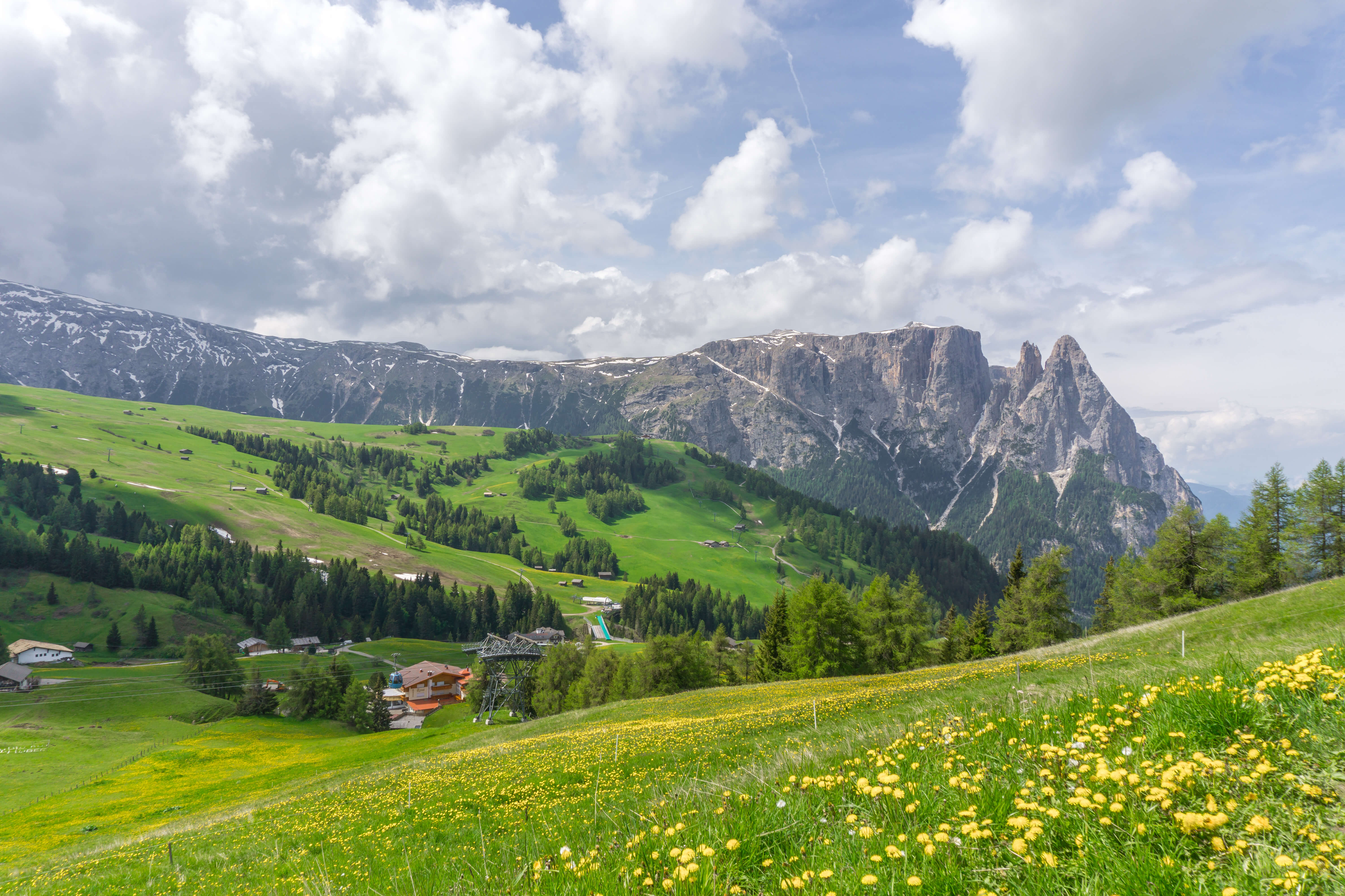
1. Bullaccia
- Difficulty Level: Easy
- Distance: 5 miles
- Time: 2.5 hours, including time to stop and eat
- Trail Type: Circuit
- Driving time from Vicenza: 2 hr 15 min
- Location for Gondola Lift Station: Seiser Alm Bahn – Cabinovia Alpe di Siuisi @ Via Sciliar, 39, 39040 Siuisi BZ
- Website for lift: seiseralmbahn.it
- Where to Eat: Ristorante Bullaccia (Puflatsch Hutte)
Located in Alpe di Siusi, this trail is a beautiful and easy hike/walk along alpine fields. You’ll find wildflowers everywhere you look during the summer, and incredible panoramic views of the Dolomites around you no matter the season of the visit. There are plenty of Rifugios along the way to stop and get a bite, have a drink, or to seek shelter from the rain (like we had to)!
Due to German influence, you’ll also see the trail name as Puflatsch instead of Bullaccia, and the location Seiser Alm instead of Alpe di Siusi.
How to get here:
There is a road that leads to the start of the hiking trail, but it’s a ZTL road to preserve nature and can only be driven on by hotel guests of that specific road. Instead, you must take the gondola to the top. Parking is free at the gondola and at the time of writing was 17€ round trip per person. It’s a short and beautiful ride to the top. They do allow dogs on the gondola, but they must have a muzzle. Always check the lift website and times before visiting to make sure that they are open!
Trail route:
Once you exit the gondola, we followed the trailheads for route 14 up and to the left. From trail 14, we also took trail PU which looped back around to a rifugio – Ristorante Bullaccia – for lunch and then the start of the trail.


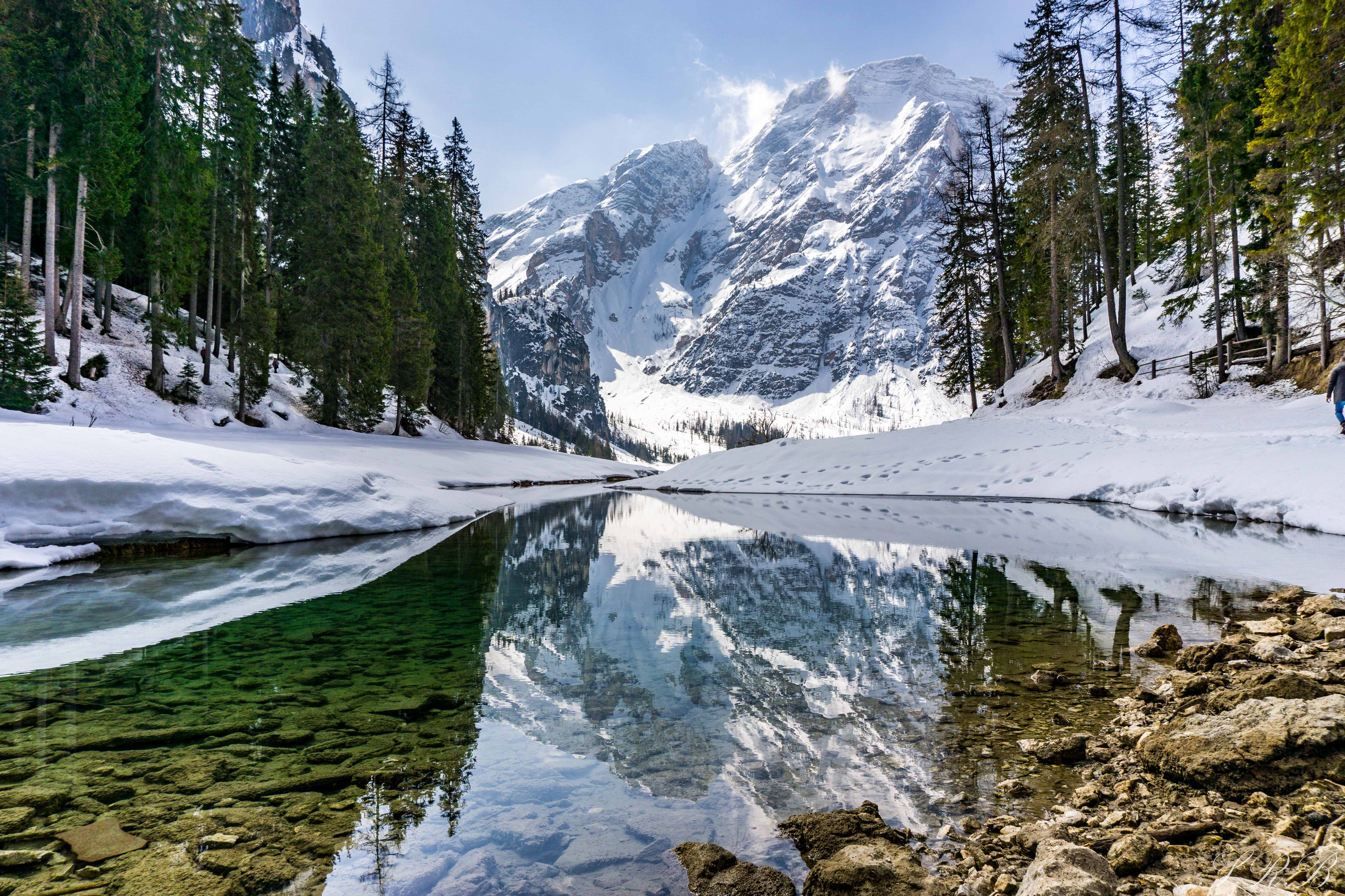
2. Lago di Braies
- Difficulty Level: Easy
- Distance: 2 miles
- Time: 1-2 hours
- Trail Type: Circuit
- Driving time from Vicenza: 3 hr 20 min
- Where to Park: Parking Lot here behind Hotel Lago di Braies
This emerald colored lake has been on my bucket list ever since arriving in Italy. I visited in mid-April with a group of friends and to my surprise, the lake was still frozen over and the path was covered in snow. However, I still to this day obsess over those snowy pics and find them just as gorgeous as the photos of the lake in the summer from social media. It may be one of the most popular lakes in the Dolomites and during the summer, it is certain to be full of visitors. Come here in the offseason for leaves changing color, snow, and for a more peaceful experience.
Trail route:
The trail is super easy to follow. Once you park in one of the parking lots behind Hotel Lago di Braies, walk down to the end of the road at the Hotel and the trail will start on your left. You’ll find benches along the way to stop and enjoy the view and charming little bridges leading into the forest. It’s a circuit trail, so you can go all the way around the lake…or do like we did when the lake was frozen over and cross it. Be extra careful when crossing a frozen lake and especially make sure that you don’t walk near any water “puddles”!


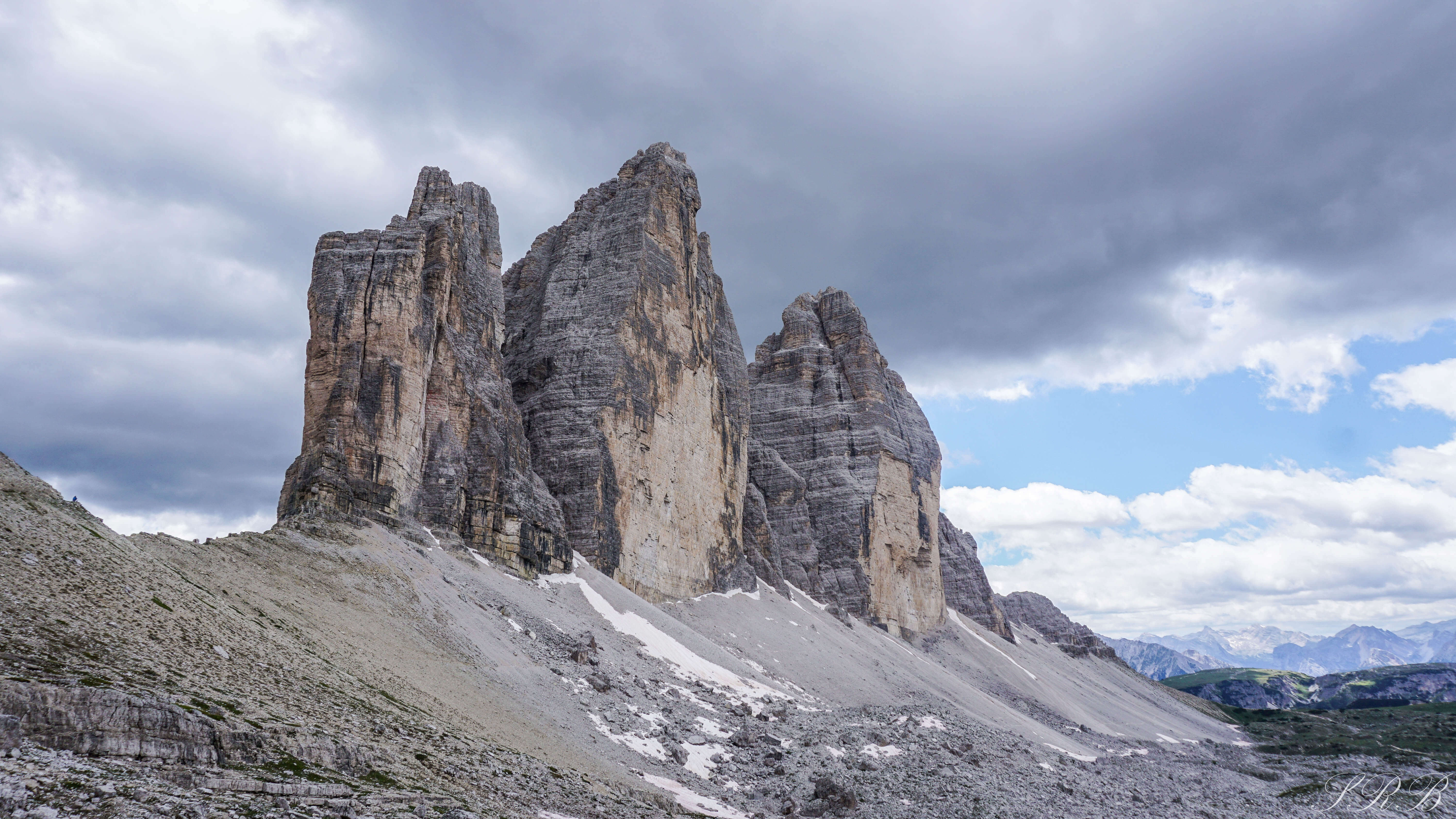
3. Tre Cime di Lavaredo
- Difficulty Level: Easy-Moderate
- Distance: 5.6 miles
- Time: 3 hr 15 min
- Trail Type: Circuit
- Driving time from Vicenza: 3 hours
- Where to Park: Rifugio Auronzo @ Localita’ Forcella Longeres, 32041 Auronzo di Cadore BL
Tre Cime di Lavaredo is Italian for three peaks of Lavaredo. These peaks are one of the most famous in the Dolomites and mighty popular on the ‘gram (Instagram, that is!). ⠀
⠀
The day we hiked Tre Cime, we drove 3 hours from my home in Vicenza. The temperature dropped from the upper 80’s when we left Vicenza down to the 40’s when we arrived at our destination. I’m usually very prepared for weather changes – rain gear, sweatshirt, etc – but with the heat wave we were experiencing, I was wearing my hiking shorts and oh boy did I regret that. ⠀
⠀
The hike started out sunny so we stayed warm for a bit, but then the clouds rolled in and the temperature dropped to below freezing. It started raining, which then turned into snow… in late JUNE. It was the craziest thing I’ve ever experienced. I tucked Presley into his blanket in my backpack and we trudged along in the hail, snow & rain mix for almost 2 hours. It was miserable, to say the least, but through it all, this was one of my favorite hikes because of the landscape and the feeling of being on a different planet. In fact, you can actually see the snow between the highest and lowest peak!
⠀
Trail route:
Starting from Rifugio Auronzo, follow trails 101 to 105 for just under a 6-mile loop hike. You will pass many rifugios along the way to stop and grab a bite to eat. We were so grateful to find an area inside one of the last ones, Malga Langalm, before the end of the hike to grab a warm drink and lunch! ⠀


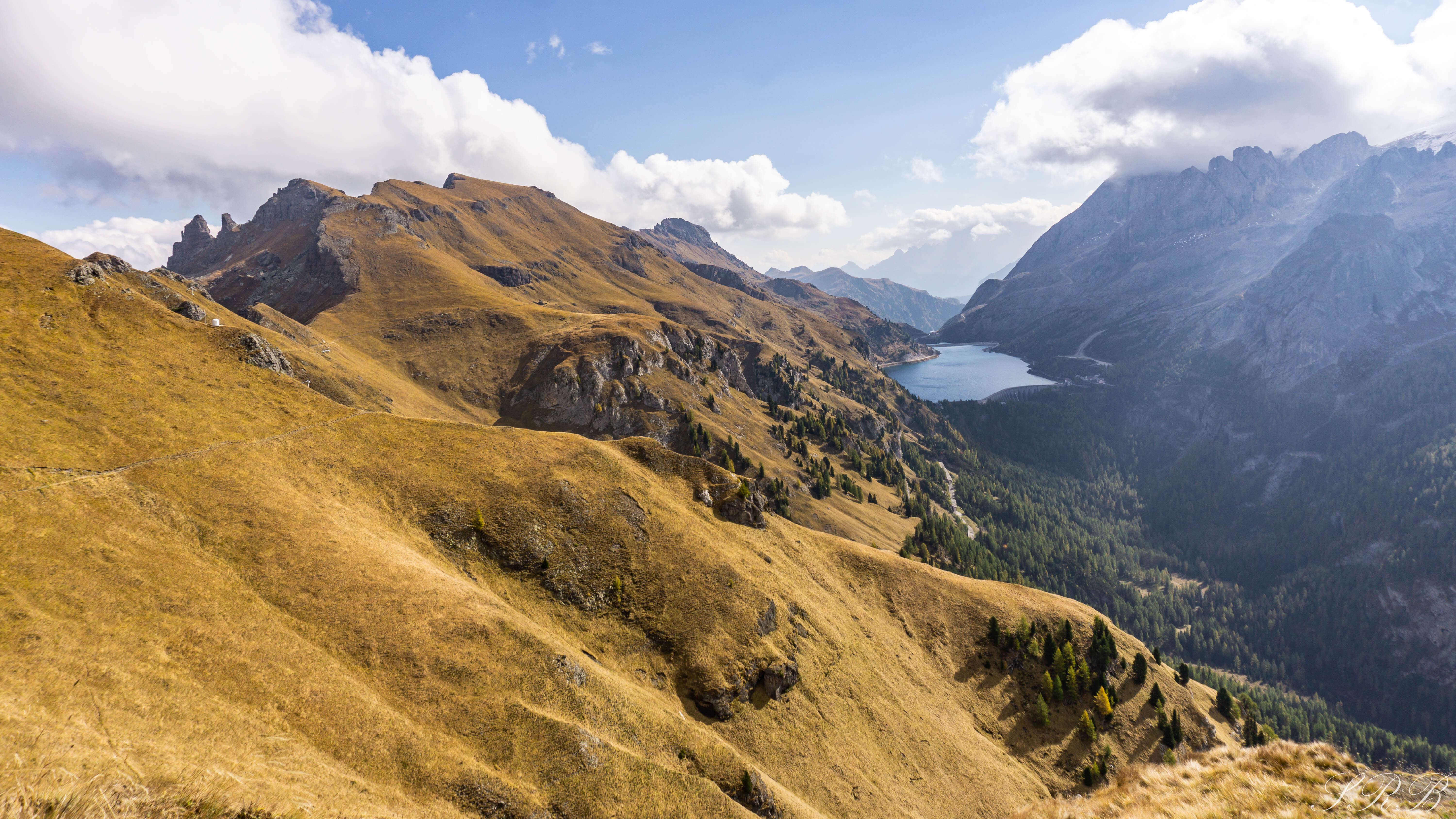
4. Passo Pordoi
- Difficulty Level: Moderate
- Distance: 6+ miles
- Time: 4 hours
- Trail Type: Down & back
- Driving time from Vicenza: 3 hr 20 min
- Where to Park: Albergo Savoia @ Passo Pordoi, 9, 38032 Livinallongo del col di lana BL
This is one of the most impressive and photogenic hikes I’ve ever done. You have an epic view of the Marmolada Glacier from the trail. Right now in the fall, it’s just beautiful and I bet it would be just as pretty in the summer with green grass and flowers! There was hardly anyone on the trails the entire time. There is plenty of parking at the base of the trail (for free). We took the no toll route there and it was beautiful. The town of Alleghe is so beautiful to drive through! It was very chilly up there early October and the rifugios along the path are closed for the offseason so come prepared. However, the restaurants at the base are open and there’s plenty of souvenir shops!
Trail Route:
Right behind Albergo Savoia is the start of the trail. You will see the trailhead signs for Viel del Pan 601. It’s a steep ascent past the church to start off with and then the rest of the hike is pretty easy. There are plenty of signs to help you along the way, it’s one of the easiest trails to follow. You can go as far as you’d like, but it’s a decently long trail. It’s about 2.2 miles from Albergo Savoia to Rifugio Viel del Pan and we went past that.


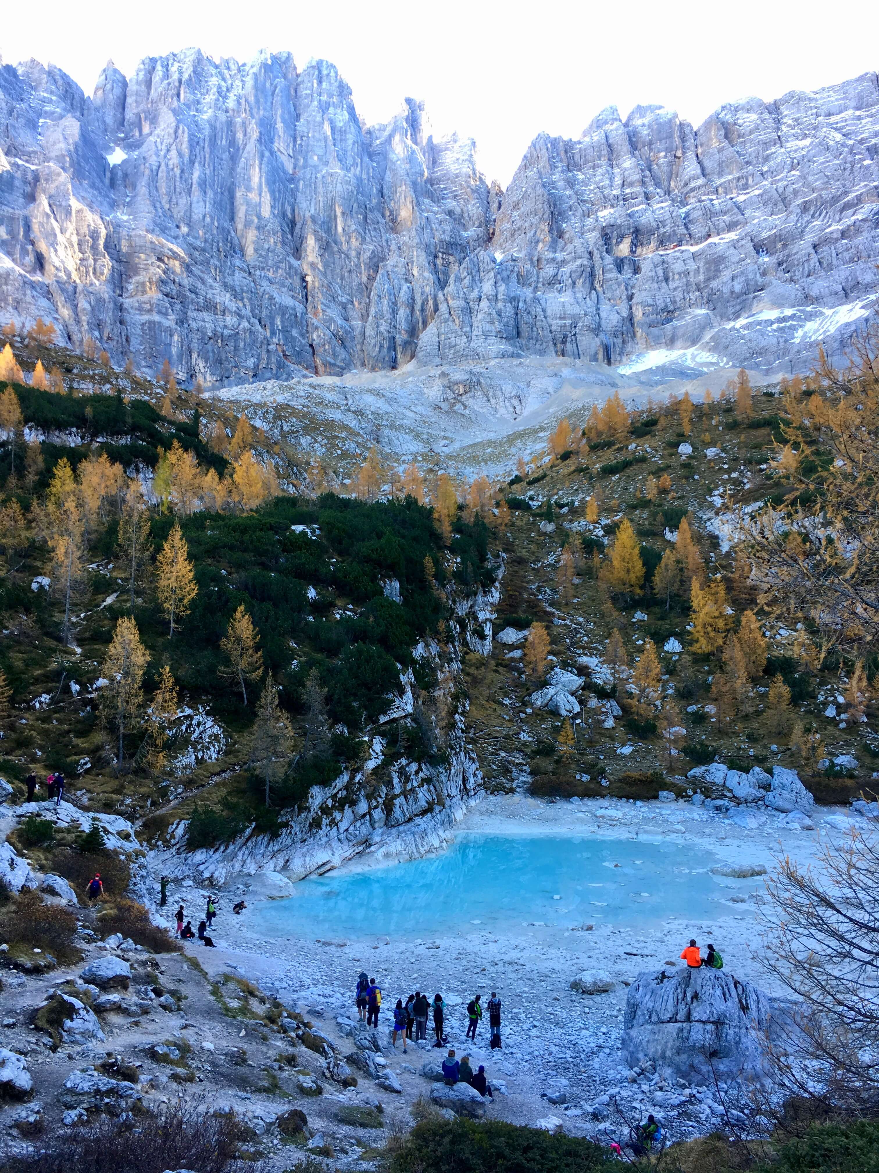
5. Lago di Sorapis
- Difficulty Level: Moderate
- Distance: 6+ miles roundtrip
- Time: 5-6 hours
- Trail Type: Down & back
- Driving time from Vicenza: 2 hr 45 min
- Where to Park: Misurina – Passo Tre Croci @ SR48, 6, 32043 Cortina d’Ampezzo BL
Lago di Sorapis is located at the foot of the Sorapis Mountain, which stands at over 10,000 feet.
This is the type of hike one usually dreams about. In the fall you’ll encounter leaves changing colors, waterfalls, and enchanting forest walks. In the summer, you’ll come upon a lake full of the bluest water you’ve probably ever seen in your life. It’s unbelievable. Breathtaking. Literally.
I hiked this trail before ever moving to Italy and we came upon this lake by total accident. In October 2017, we were with a group of friends in Cortina d’Ampezzo and the original hike we had planned had to be canceled because the gondola lift station was closed that time of the year. We decided to drive up the mountain a little farther and saw a bunch of cars parked on the side of the road near. We pulled in and decided to hike this trail, having NO idea what we would find at the end, and it was the best surprise!
Trail Route:
The trail was so unique, ever-changing and definitely not for the beginners. Some parts were flat. Some parts were very strenuous but didn’t require hiking gear. Follow Route 215 to the lake. You’ll pass through the forest, along waterfalls, and over cliffs before arriving at the lake. Hiking poles and hiking boots are highly suggested for this trip. In mid-October, there wasn’t a lot of water which was unfortunate because it looked beautiful in google maps. It took us a little under 6 hours to reach the lake and hike back to the car.


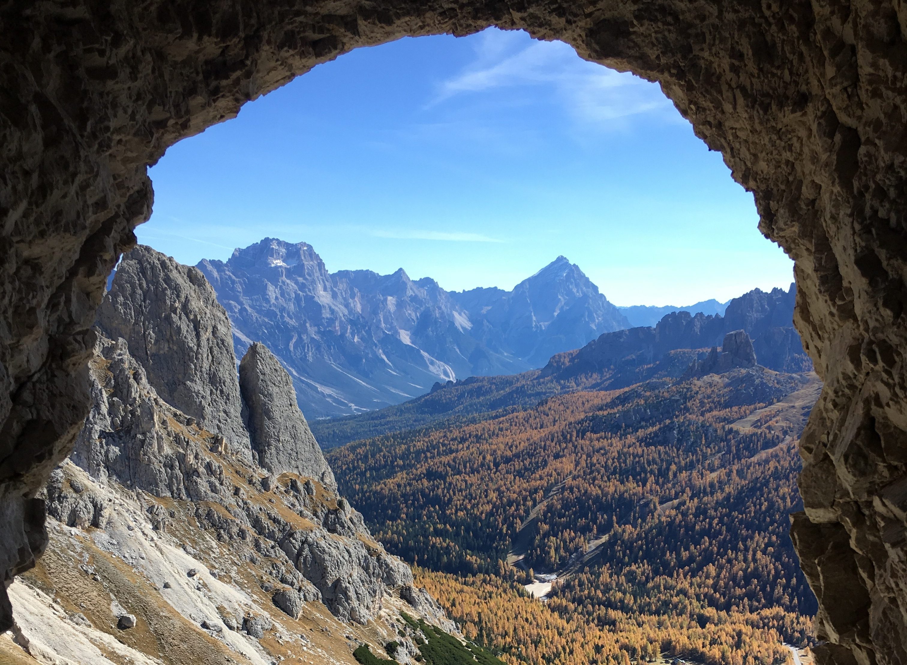
6. Falzarego Pass
- Difficulty Level: Hard
- Distance:
- Time: 5-6 hours
- Trail Type: Hike up, lift down
- Driving time from Vicenza: 3 hours
- Where to Park: Rifugio Passo Falzarego @ SR48, 32043 Cortina d’Ampezzo BL
- Website for lift: https://lagazuoi.it/Eng/pageP35-Ticket-Prices
How to get here:
Drive up to Falzarego Pass – a high mountain pass in the Province of Belluno in Italy – just past downtown Cortina d’Ampezzo. They have a huge parking lot where you can park for free and it was a jam-packed day due to the beautiful weather forecast.
Trail route:
The first 200 meters of the hike from the parking lot was quite brutal. It was a steep incline and the trail is pretty difficult. The Lagazuio Mountain Path is very unique and includes lots of caves, tunnels, and steps. Like dark, dark, dark steep, straight up through the mountain type of steps. Inside the tunnels, it is vital that you have a headlamp, or else you’ll be walking a long while in pitch black. When we visited in October, it wasn’t too cold and the water in the tunnels was not frozen, slick, or iced over. The best time to visit is during the summer or fall.
The cool part of this hike is that it is a historical landmark. All throughout the path, there are signs marking the structures and what happened during World War I where the Italian and Austro-Hungarian forces ran through the Dolomites. Mines and a number of long-distance footpaths were used extensively. The soldiers would often be stuck in the tunnels of the Dolomites for a very long time and for this reason, they built barracks as a temporary housing. There were also lots of bunkers that we saw along the path.
Instead of taking the path back down, we utilized the cable car that runs until mid-October of each year. Make sure to purchase a ticket at the cable car shop at the base before beginning your hike. It will cost you around 11 € one way.


**Related Post: Hiking and Cow Festivals: A Cool October Weekend in Cortina d’Ampezzo, Italy
The mountains are calling you! I hope after reading this post, it has inspired you to get outdoors and hit the hiking trails in the Dolomites. There is a trail out there for every type of hiker (or climber – see here!). If you have any trails I MUST add to the list and experience for myself, let me know in the comments below. Happy hiking!!


7 Comments
Natasha
Wow, what a stunning place. I’ve been seeing more and more of the Dolomites and I’ve really got the urge to visit. Love snowy peaks.
lpnieman
Love this! I have been to the Dolomites a couple of times and now have some more info on trails to hike for my next visit!
Pingback:
Pingback:
Pingback:
Pingback:
Pingback: